The highest point on the Słowiński coast - 115 metres shaped like a truncated cone, once a sacred mountain to the Slovincians. From the 20-metre tower at the top you can see both park lakes, the Baltic, and the Czołpino lighthouse.
The viewing tower on Rowokół is open from 1 May to 30 September, and tickets cost 10 zł, or 5 zł reduced. From Rowy it is about 15 minutes by car to Smołdzino and about 20 minutes on foot along a 1 kilometre trail with gradients of up to 10 percent. Since March 2026 the direct steps to the summit have been closed, the only way up is the blue trail from the petrol station, and dogs are not allowed on the tower.
Opening hours and tickets
The tower is open from 1 May to 30 September. In May, June and September you can go up between 9:00 and 18:00, and in July and August until 20:00. Outside the season the tower opens only for groups of 10 or more. A standard ticket costs 10 zł and a reduced ticket 5 zł, while children under 7, residents of the surrounding municipalities and holders of the Large Family Card (the Polish national scheme for large families) go up free. In strong wind, fog and storms the tower is closed, so in uncertain weather it is worth having a back-up plan.
Getting to Rowokół from Rowy
From Rowy you drive to Smołdzino, about 15 minutes by car, and carry on from there on foot. The trail from the car park is about 1 kilometre long and takes roughly 20 minutes, with gradients reaching 10 percent. One important change: since March 2026 the direct steps to the summit have been closed, and the only way up is the blue trail from the petrol station.
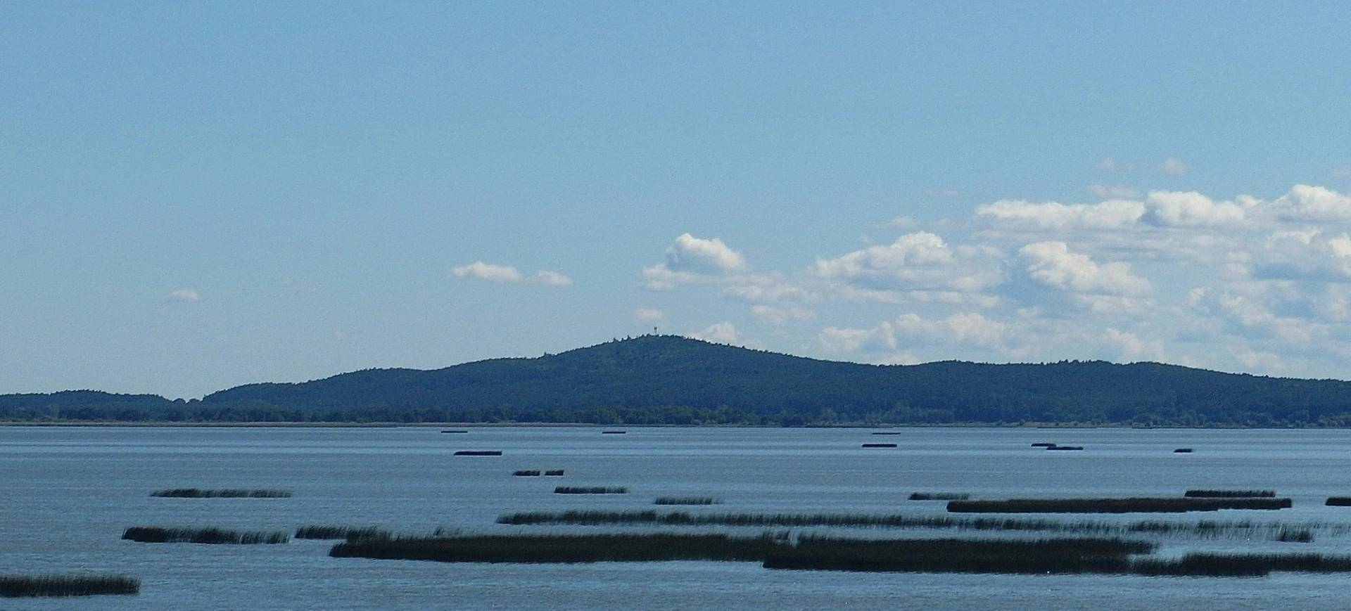
What you can see from the viewing tower
The tower is 20 metres high and has a terrace with views in all four directions. From it you can see the Baltic, Lake Łebsko and Lake Gardno, as well as the Czołpińska Dune and the lighthouse at Czołpino. From a single terrace you look out over both of these large lakes and the sea at once.
The holy mountain of the Slovincians
Rowokół is a post-glacial hill shaped like a truncated cone, a rarity on this stretch of coast, where flat sandbars and peat bogs dominate. At 115 metres above sea level it is the highest point on the whole Słowińskie Coast. Archaeologists have found circular ramparts here with a large sacrificial hearth dated to the 9th-11th century: the hill was a pagan centre of the cult of Swarożyc.
After Christianisation a chapel of Saint Nicholas, the patron saint of sailors, was built here, and for centuries pilgrimages made their way up Rowokół. The chapel was dismantled after the Reformation, and the last foundations disappeared in the middle of the 19th century. Earlier still, in the age of sail, fires lit on the summit served fishermen returning from the Baltic as a primitive lighthouse.
Rowokół with children and with a dog
The climb is short but steep: 1 kilometre with gradients of up to 10 percent, so with small children it is worth allowing extra time and taking water. Dogs are not allowed on the tower, so for a walk with a dog the beach in Rowy outside the swimming season is a better choice.


